What Milwaukee Houses Stand On: Clay Till, River Flats and Frost
Milwaukee soil explains most of what happens to its basements. Glaciers moving out of the Lake Michigan basin left layers of clay-rich till, and the river valleys hold softer, younger mud. Add a long freezing season and heavy summer storms, and the common repairs make sense.
Borings logged for a 1983 Wisconsin Geological and Natural History Survey study found up to 60 meters of glacial and river deposits under the lower Milwaukee and Menomonee valleys. Wisconsin code rates clay at 60 psf per foot of depth against a wall, twice clean gravel.
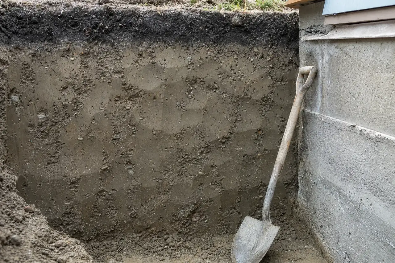
What is glacial till, and why is Milwaukee soil so clayey?
Till is the debris a glacier leaves behind as it melts, never sorted by running water, so clay, silt, sand and pebbles end up mixed together. The 1983 survey study, built on more than 200 borings drilled for Milwaukee's Water Pollution Abatement Program, describes the local Oak Creek till as stiff to hard, gray to pinkish gray silty clay to clayey silt, and the younger Ozaukee till as stiff to hard, reddish brown silty clay. Between the tills lie layers of fine lake sediment, stiff clay laid down in lakes at the edge of the ice. Clay this dense carries a house well but drains slowly, so water lingers against basement walls.
How much does clay push on a basement wall?
Wisconsin's dwelling code, SPS 321.18, answers with a table. For moist soil without water pressure, clean gravels and sands are rated at 30 pounds per square foot per foot of depth, silty sands at 45, and low- to medium-plasticity clay at 60. High-plasticity clays and organic soils are listed as unsuitable as backfill. Saturated soil adds hydrostatic pressure on top of those figures. A 7-foot depth of wet clay therefore loads the bottom of a wall far more than the same depth of gravel, which is why so many block walls here crack sideways; see bowed basement walls.
The soft ground along the rivers
The same study maps a different world in the lower Milwaukee and Menomonee valleys, from the harbor up to the North Avenue dam and west to the 27th Street viaduct. Old maps show those low areas were mostly wetland, with patches of drier ground. The deposits there are estuarine: organic-rich to peaty silty clay and clayey silt laid down in marshy backwaters, generally soft and quite compressible. Houses on or near former wetland, or on fill, are more likely to see a corner settle; see settling corners and stoops.
Frost depth, freezing nights and storm rain
Wisconsin's code sets footings, including those for stoops, below the frost line or at least 48 inches below grade, whichever is deeper. NOAA's 1991–2020 normals for Milwaukee Mitchell Airport count about 123 nights a year at or below freezing, 50 days that stay below freezing all day and 48.7 inches of snow. Rain comes hardest in summer: 11.4 of the year's 34.6 inches fall in June, July and August, and about 7 days a year bring an inch or more. In August 2025 a northwest Milwaukee gauge caught 14.55 inches in under a day, a state record. Drainage is covered on the basement waterproofing page.
Sources
- Wisconsin Geological and Natural History Survey, Geoscience Wisconsin vol. 7 (1983): Quaternary stratigraphy of the lower Milwaukee and Menomonee River valleys (PDF)
- Wisconsin Administrative Code SPS 321.18: Foundations (soil lateral load table)
- Wisconsin Administrative Code SPS 321.16: Frost protection
- NOAA NCEI: U.S. Climate Normals 1991-2020
- National Weather Service Milwaukee/Sullivan: New Wisconsin state precipitation record
Tell us what the basement is doing
A crack you have been watching, water after a storm, a stoop leaning away from the house: a sentence or two is enough. It goes to one independent foundation and waterproofing specialist who works in Milwaukee.